Purkeypile
Consulting, LLC
www.purkeypileconsulting.com
Richard
Dee Purkeypile, P.E.
Dam
Safety Engineering & Water Resources Consulting
Phone: (512) 971-2264
email: dtpurkeypile@cox.net or
Purkeypile Consulting, LLC was formed in July of 2010 for the purpose of
providing professional engineering services to owners of dams in Texas. Richard Dee Purkeypile, P.E. is the president and sole operator of
Purkeypile Consulting. Mr. Purkeypile also acts as a dam safety
engineering consultant to engineering firms that do not have an in-house
specialist with experience in the assessment, analysis, design, repair and
construction of dams.
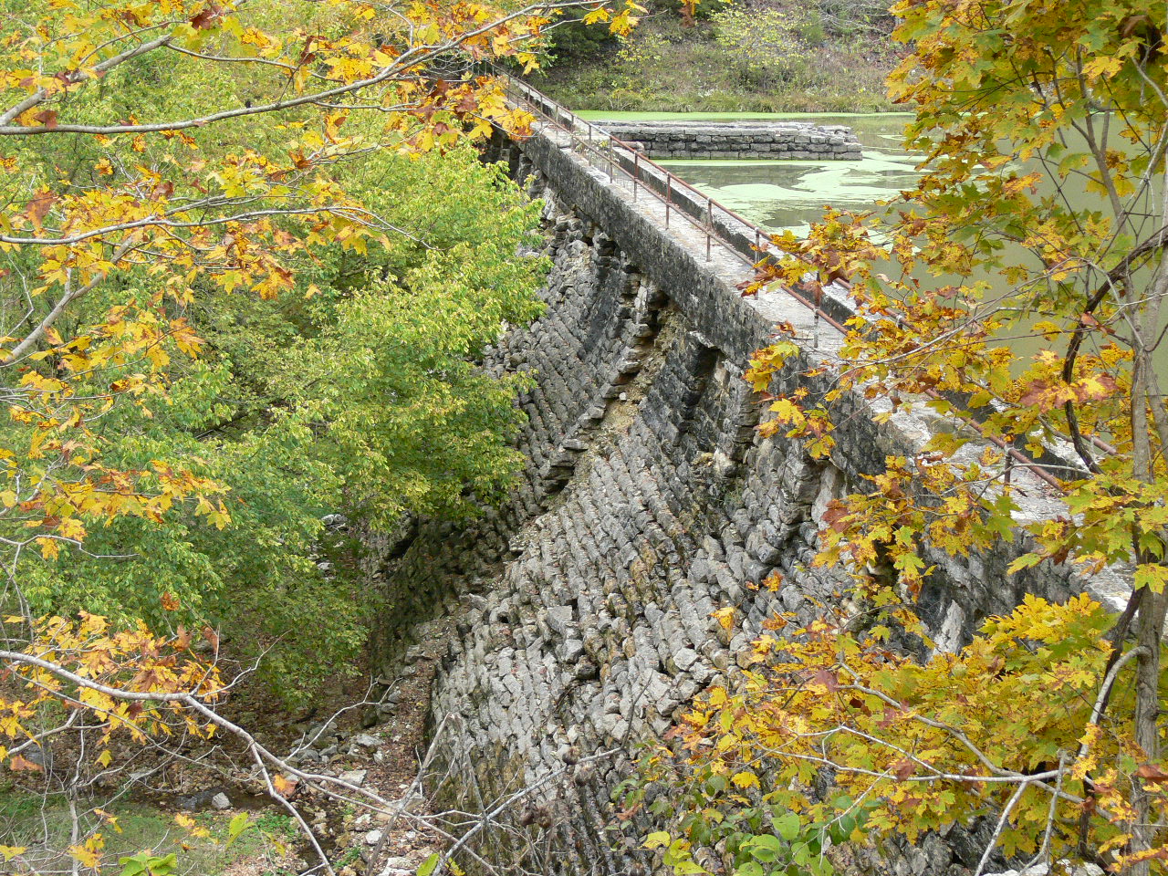
Eureka Springs, AR
Black Bass Dam
1.
On-Site Assessments and Dam Safety
Inspections
2.
Operation & Maintenance Plans
3.
Hydrologic Analysis of the
contributing drainage area of dams.
4.
Hydraulic Analysis of the existing
or proposed spillways for dams.
5.
Static Stability Analysis of earthen
or concrete dams.
6.
Breach Analysis (dynamic or
simplified).
7.
Emergency Action Plan development.
8.
Plans & Specifications for new
construction or rehabilitation of existing dams.
9.
Bid Phase and Construction
Inspection services for new or existing dams.
10.
Water Rights assistance.
Mr. Purkeypile has 15 years of experience with the Texas Dam Safety
Program and functioned as a senior engineer with that agency prior to
entering private engineering consultation. During his tenure with the Dam
Safety Program he performed over 400 hundred dam safety inspections,
performed over 200 hydrologic and hydraulic (H&H) analyses and
performed 60 breach analyses of dams.
Mr. Purkeypile has worked in the private sector for 12 years and has
inspected over 500 dams and has performed H&H and breach analyses for
over 150 dams.
The engineering analysis of a dam often leads to the improvement of an existing dam or the construction of a new dam. Purkeypile Consulting has developed plans and specifications and has provided construction observation for 30 dams and currently has five dams under various stages of construction.
The
following is a description of a typical dam safety engineering project.
The specific project may entail some or all of the steps noted below:
Data
Collection: Data is collected from the dam owner and the state or federal agency
that regulates the dam. The data may include: engineering studies, plans
& specifications of the original construction or any modifications,
geotechnical reports, computer models, paper copies of reports, regulatory
correspondence, maps, photography, etc. All data is copied and provided to
the dam owner for future reference.
On-Site
Assessment: A site visit is performed which includes a detailed physical inspection
of the surface of the dam and all of its appurtenances. The dam may
consist of an earthen embankment with low flow outlets, principal
spillways and emergency spillways and spillway diversion berms. Other
areas may also be inspected such as gated spillways, raw water intake
facilities for water treatment plants as well as irrigation and possibly
recreations facilities.
An
inspection report is generated that provides observations of deficiencies
and recommendations for the repair and maintenance of the dam.
The
on-site assessment also includes a downstream hazard determination.
Existing U.S.G.S. topographic maps and the most recent available aerial
photography is used to indentify houses, commercial buildings, roadways,
railroad embankments and critical infrastructure. A downstream
investigation is performed that includes determining the finished floor
elevations above the adjacent creek of all habitable structures. A
preliminary hazard classification is made. The investigation identifies
the surveying needs for future breach analysis needs which will finalize
the hazard classification.
Operation
and Maintenance Plan: Many
states require an O&M plan for regulated dams. They typically include
a schedule of regular maintenance items and the course of action needed
for repair activities. Normal maintenance personnel are listed as well as
emergency responders. Locations are identified for the staging and storage
of repair materials. Monitoring activities might include periodic
observation and measurement of seepage flow or monitoring concrete crack
movement or unstable areas on earthen embankment. An O&M Plan is
developed specific to each dam.
Hydrologic
& Hydraulic (H&H) Analysis: The
drainage area is determined using USGS topographic maps or, if available,
from survey or LIDAR mapping. Soils and land use data are obtained from
the USDA Natural Resources Conservation Service (NRCS) which are used to
derive runoff curve numbers. The times of concentration are developed
using average stream hydraulics. Elevation, area, and capacity data are
developed for the impoundment using average end-area calculations. The
discharge rating curves for the spillway are determined using various
hydraulic computer models, spreadsheets and nomographs. The rating curves
are often extended above the top of dam elevation in order to model flow
over the dam during a breach analysis.
The
H&H analysis can vary from one small basin with one dam to multiple
basins with multiple dams in series or laterally contributing to the
stream flow.
An
engineering report is generated that discusses the hydraulic adequacy of
the dam per state regulation. Hydraulically inadequate dams are further
studied to determine whether the dam should be raised or the spillway
widened or a combination of both. Recommended spillways may include but
are not limited to: earthen spillways with grass or high performance turf
reinforcement mat as erosion protection, reinforced concrete or other hard
armoring such as rock rip rap or articulated concrete block revetment,
drop inlet or morning glory spillways, labyrinth weirs, ogee crests, gated
spillways, etc.
Breach
Analysis and EAP Preparation: Emergency
Action Plans require that a breach analysis be performed for the dam.
Simplified breach analysis is allowed in some states; however, the
preferable method is a detailed dynamic breach routing. The dynamic
routing provides better attenuation of breach flow sin the downstream
valley. The dam is breached under various scenarios which include:
internal erosion during a non-flood event (“Sunny-day breach), a barely
overtopping storm event and finally the required test flood event. If the
soil parameters are know for an earthen embankments then sediment
transport equations are used to derive the time of the breach formation
and the final breach geometry. Otherwise, there are standard parameters
available from the National Weather Service, Corps of Engineers and the
Bureau of Reclamation to determine the time of maximum breach formation
and the final geometry of the breach. The breach wave is routed downstream
using valley cross section information taken from contour maps or ground
surveys. Obstructions and channel constrictions from roadways, railroads
or channel geometry are defined. Wide expansive areas that may provide
dead storage and attenuation of flood flows are also defined. The breach
study area includes the dam and the area downstream of the dam where the
breach versus non-breach water surface differential is less than one foot.
An
inundation map will be developed for the dam using the most recent
available aerial photography with contour overlays. The map will show the
design storm breach and the “Sunny Day” breach footprint below the dam
and will identify homes that will need to be evacuated during a breach
condition. The inundation map will also have depths and velocities of flow
over road crossings and at any inundated residences. A breach analysis
report will be created for the dam which includes breach wave travel times
and peak water surface elevations for downstream residents.
The
breach analysis and the inundation map will be included in the EAP which
also includes an emergency notification flow chart that has the contact
information and chain of command for the emergency responders for a dam
safety emergency. The names addresses and phone numbers of downstream
residents are provided on an emergency call list. Emergency procedures are
enumerated and broadcast emergency messages are listed. Emergency assembly
locations and evacuation routes are shown on the inundation map.
Plans,
Specifications, Bid & Construction Inspection Services: The
H&H analysis may require that existing dams be modified to safely pass
the state’s required test flood. Existing dams may also experience
damage as a result of large storm events. The State Of Texas requires that
plans and specifications be developed by a qualified engineer with
experience in the design, repair and construction of dams. Purkeypile
Consulting can develop plans and technical specifications that follow the
accepted engineering practices and design requirements of Texas.
Additionally, services are provided for estimation of materials
quantities, bid phase services, and construction inspection services to
insure that the contractor performs as directed by the plans and
specifications. Theses services are also provided for the site assessment
and design of new dams.
Computer
Programs: The following is a list of computer programs that are typically used in
a dam safety engineering project.
U.S. Corps of Engineers: HMR-51, HMR-52, HEC-1, HEC-HMS, HEC-2, HEC-RAS,
HEC-GeoRAS
National
Weather Service: NWS-DAMBRK, NWS-BREACH, NWS-FLDWAV
Natural
Resources Conservation Service: DAMS2, SITES, TR-55, WSP2
Technical
References: The
following technical references are used and are considered to be accepted
engineering practice.
U.S.
Corps of Engineers:
Engineering Manuals, HEC Hydraulic Reference Manuals
USDA NRCS:
National Engineering Handbook, TR-55, TR-60, TR-66, Technical Notes, Soil
Surveys
Bureau of Reclamation: design
of Small dams, SEED Manual
Federal Highways
Administration: FHWA hydraulics
reference library which includes Hydraulic Design Series, Hydraulic
Engineering Circulars, Hydraulic Reports
National Oceanic and Atmospheric Administration (NOAA): Precipitation data found in Technical Papers,
TP-40, TP-35, TP-49
National Climatic Data Center (NCDC): Archived weather
data of the United States.
U.S. Geologic Service (USGS): Scientific Investigations Reports, stream gage data, topographic maps.